PORT RICHMOND
Staten Island
Geographic Setting
Bounded by Clove Road to the east, Forest Avenue to the south, the Dr. Martin Luther King Jr. Expressway (Route 440) to the west, and the Kill Van Kull to the north, Port Richmond stands as one of Staten Island’s oldest and most historically significant neighborhoods. Situated along the North Shore, it occupies a commanding stretch of waterfront overlooking the deep tidal channel that separates Staten Island from Bayonne, New Jersey. The neighborhood rises gently from the working piers and industrial lots along Richmond Terrace to tree-lined residential blocks and bustling commercial corridors inland.
At its core lies Port Richmond Avenue, the historic main street once known as “Richmond Avenue,” which runs south from the waterfront through a dense grid of 19th-century rowhouses, shops, and civic buildings. To the east and west, side streets fan out toward schools, churches, and small parks, while the hum of passing ships and trucks along the Kill Van Kull recalls the area’s maritime and industrial roots. Its geography—an anchorage, a crossroads, and a cultural artery—has long made Port Richmond both the heart of Staten Island’s commerce and a living chronicle of its evolution from colonial harbor to urban borough.
Etymology
The name Port Richmond emerged in the early 19th century as part of the area’s transformation from the rural village of Roe’s Point into a thriving maritime and commercial hub. “Port” emphasized its identity as a harbor along the Kill Van Kull, where docks and ferries connected Staten Island to New Jersey and Manhattan, while “Richmond” reflected the island’s historic county name—Richmond County.
By the 1830s, the name had become synonymous with prosperity and modernity. It replaced older local terms such as “Roe’s Hook” and “Mercer’s Dock,” aligning the community’s image with its growing importance in shipping and trade. Over the decades, Port Richmond came to signify not only a geographic place but also an idea of industriousness and diversity—a name that still resonates with pride among its residents.
The Neighborhood
Origins through the 19th Century
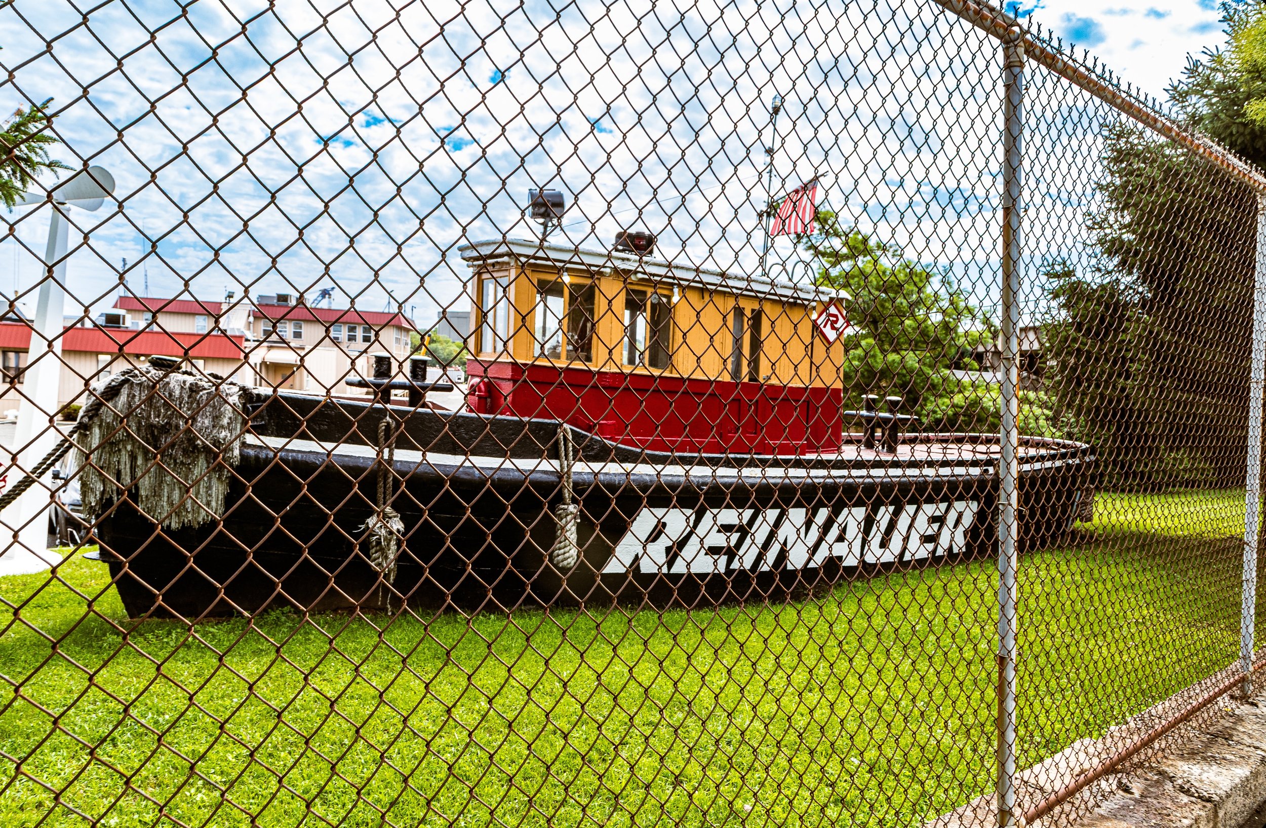
Port Richmond’s origins stretch back to the 17th century, when Dutch and English settlers established farms and ferry landings along the Kill Van Kull. The area’s natural harbor made it a focal point for maritime activity, and by the late 1700s, it served as an important crossing point to New Jersey. A ferry to Bergen Point (Bayonne) operated as early as 1708, connecting Staten Island farmers to regional markets.
In the early 19th century, entrepreneur Cornelius Vanderbilt, born nearby in Stapleton, helped expand ferry operations and coastal trade, setting the stage for Port Richmond’s emergence as the North Shore’s principal port. Warehouses, shipyards, and brickyards lined the waterfront, while inland, small businesses, inns, and homes clustered along Richmond Avenue (now Port Richmond Avenue). By mid-century, the area had become Staten Island’s commercial center, attracting merchants, shipwrights, and laborers.
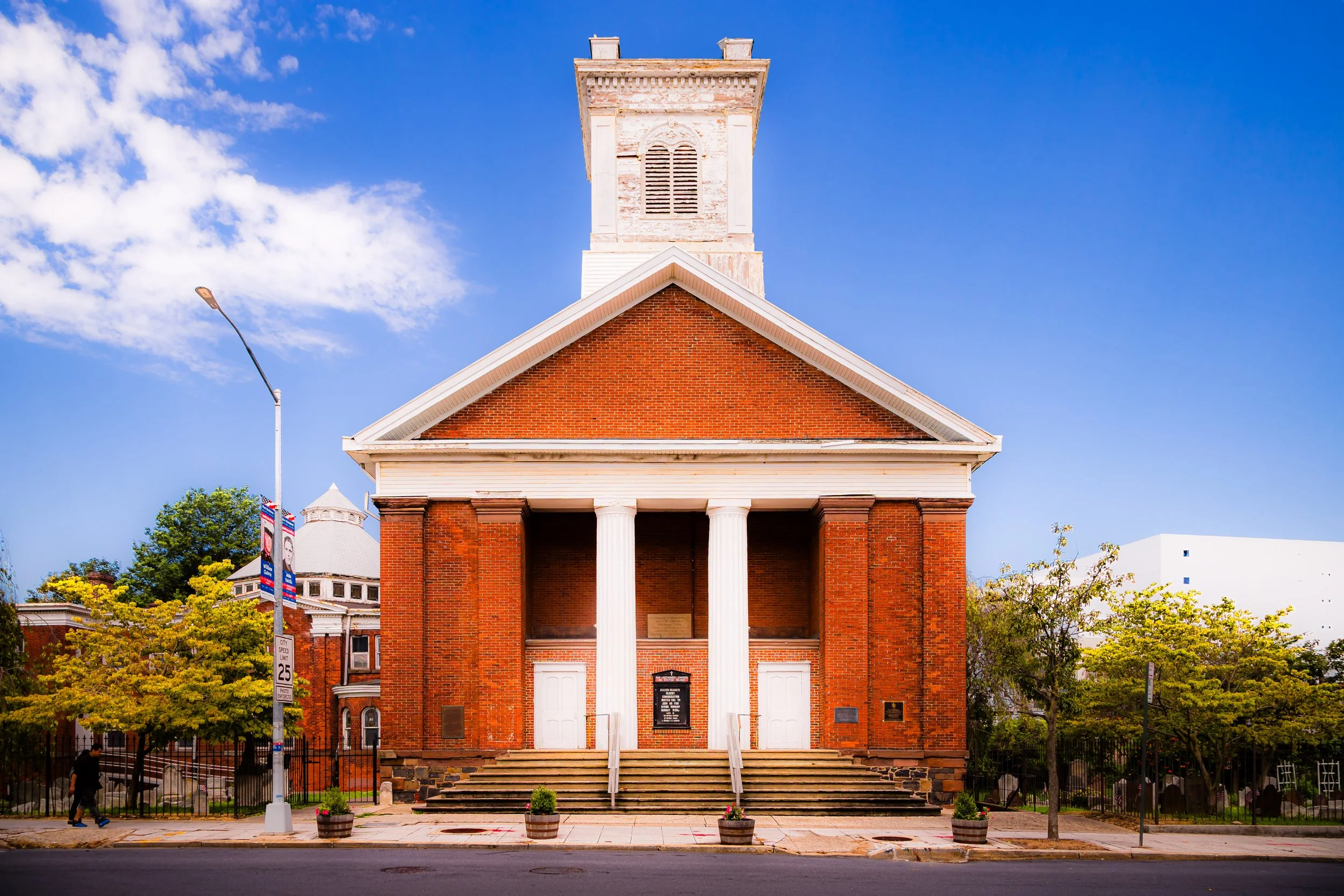
The construction of St. Mary’s Church (1852), Port Richmond Public School (1844), and the Reformed Protestant Dutch Church (1845) reflected a flourishing civic life. The neighborhood’s diversity grew as immigrants—first Irish and German, then Italian, Polish, and Jewish—settled in the area, drawn by employment at the docks and nearby factories. In 1866, Port Richmond was incorporated as a village within the town of Northfield, boasting paved streets, gaslights, and public ferries.
By the late 1800s, it was known as the “Downtown of Staten Island,” a place where commerce, industry, and culture converged. Horse-drawn streetcars connected it to other island communities, and Richmond Terrace, the coastal road running east–west along the Kill Van Kull, became one of Staten Island’s busiest thoroughfares.
Early 20th Century: Commerce, Community, and Growth
At the dawn of the 20th century, Port Richmond thrived as Staten Island’s premier shopping and business district. Its dense commercial corridor along Port Richmond Avenue featured department stores, banks, and theaters. The Ritz Theatre, Loew’s Port Richmond, and other landmarks drew patrons from across the borough. Meanwhile, factories along the waterfront produced lumber, paints, and building materials, while ferries continued to carry passengers and freight across the Kill Van Kull.
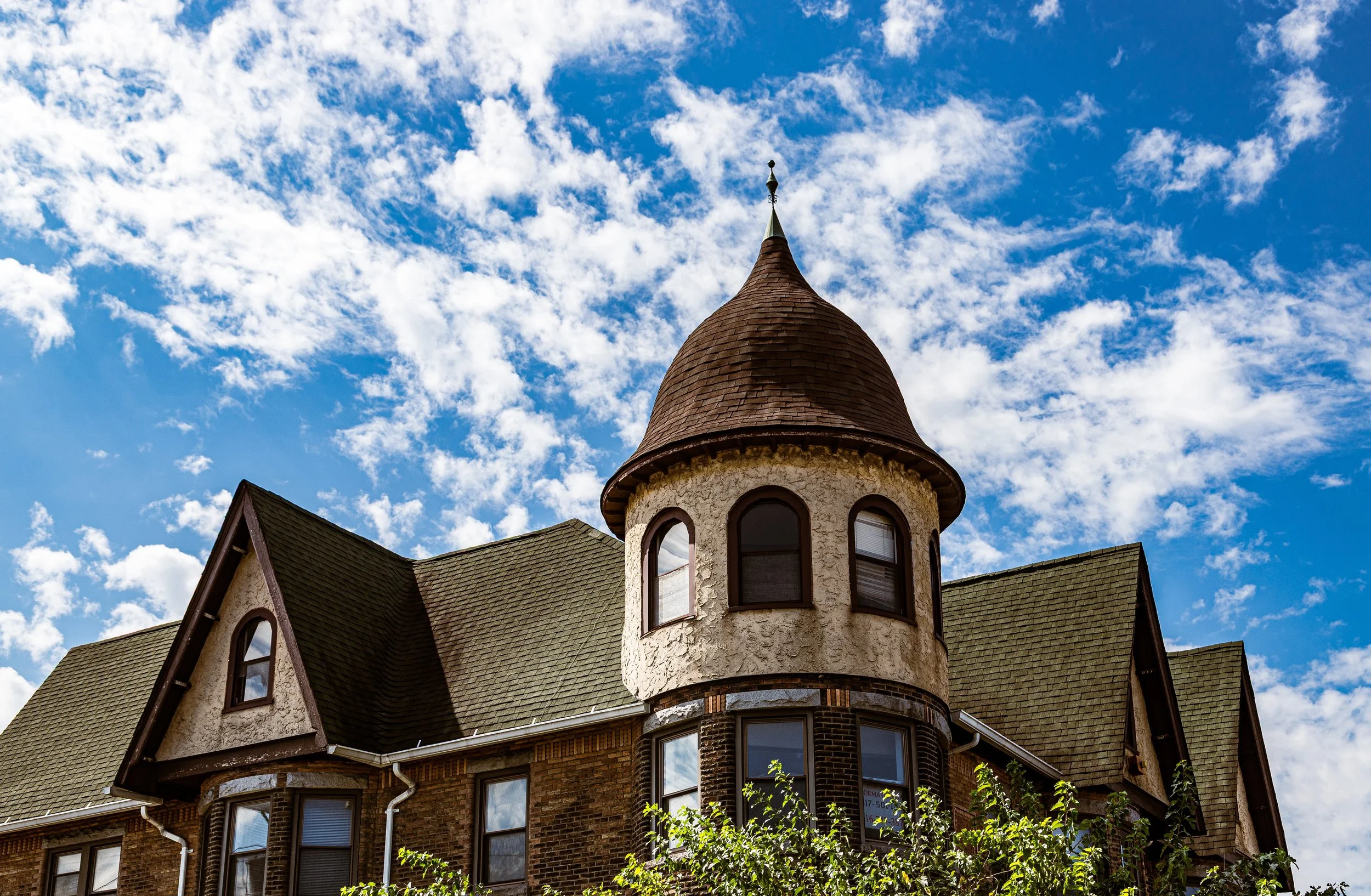
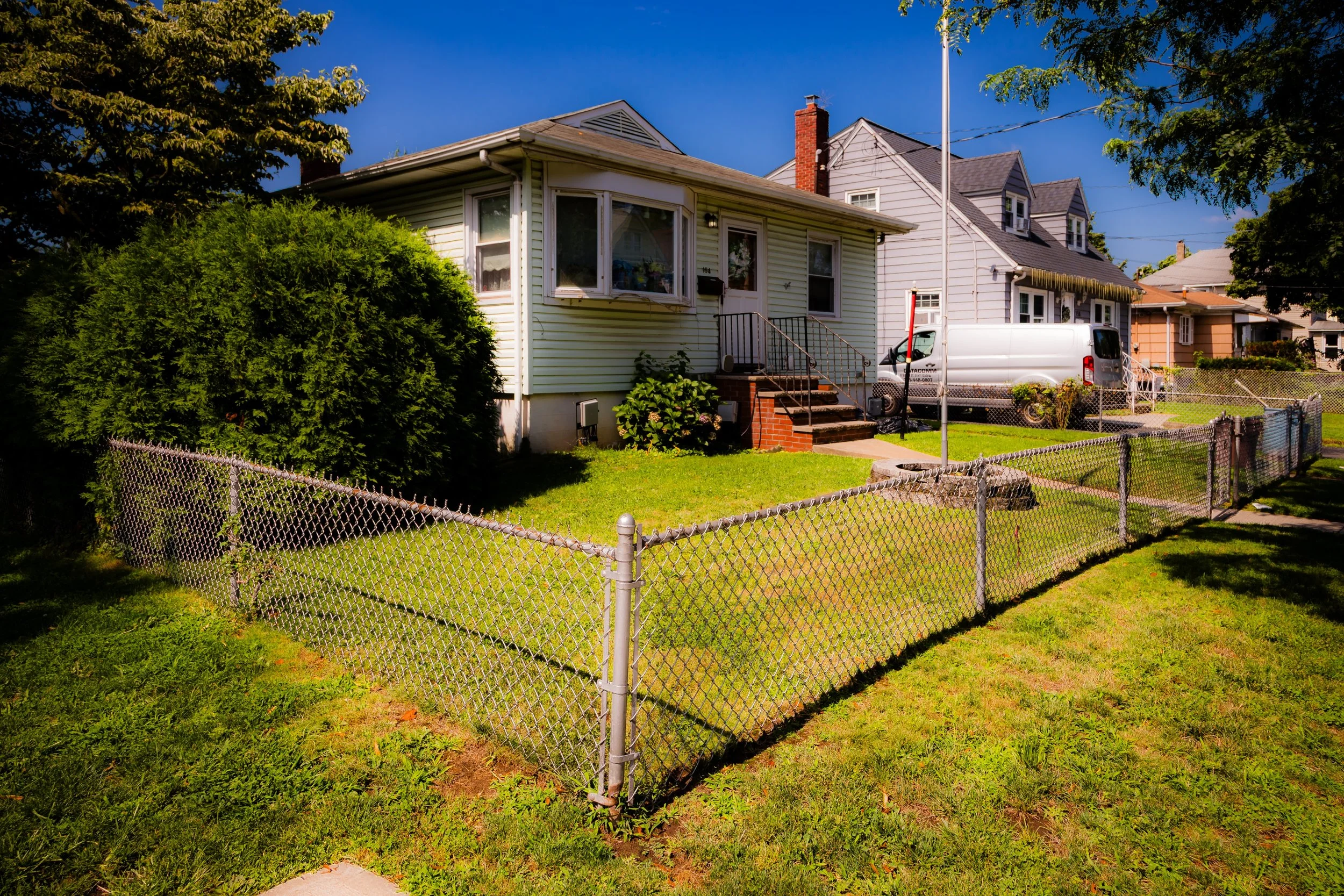
Residential neighborhoods grew around this bustling core, characterized by Victorian homes, brick rowhouses, and modest bungalows. The opening of the Bayonne Bridge (1931) reinforced Port Richmond’s status as a key link between Staten Island and New Jersey. At the same time, Staten Island’s integration into New York City (1898) brought new infrastructure and municipal investment—paved roads, modern schools, and improved public services.
Culturally, the early 20th century was a time of remarkable vitality. Immigrant communities sustained ethnic churches, benevolent societies, and businesses, creating a mosaic of Italian bakeries, Irish pubs, Jewish delis, and Polish grocers. The waterfront teemed with longshoremen and sailors, while inland, families built intergenerational stability through small enterprise and civic engagement.
Port Richmond Video Coming Soon
Mid–Late 20th Century: Industrial Decline and Urban Challenge
The mid-20th century brought sweeping changes to Port Richmond, reflecting the broader shifts of urban America. The rise of automobiles and the construction of the Dr. Martin Luther King Jr. Expressway (1950s–60s) diverted traffic from Port Richmond Avenue, while the decline of shipping and manufacturing along the Kill Van Kull eroded the neighborhood’s industrial base. Containerization and the growth of the New Jersey ports drew maritime business away from Staten Island, leaving many piers abandoned.
At the same time, suburbanization pulled middle-class families toward newer developments farther south on the island, and the area’s economy entered a prolonged downturn. Yet even amid these struggles, Port Richmond remained a community of deep-rooted families and strong institutions. St. Mary’s Church, Our Lady of Mount Carmel–St. Benedicta School, and the Port Richmond High School (founded 1928) continued to serve as anchors of continuity and pride.
The 1970s and 1980s saw demographic change as new immigrant populations—particularly from the Caribbean, Latin America, and later Mexico—settled in the area, revitalizing housing and commerce. Although economic disinvestment and rising poverty presented challenges, grassroots activism flourished. Organizations such as the North Shore Alliance and Project Hospitality emerged to address housing, education, and social services, setting the stage for community renewal.
21st Century: Diversity, Renewal, and Revitalization
In the 21st century, Port Richmond has reemerged as one of Staten Island’s most dynamic and culturally diverse neighborhoods. Today, it is home to a vibrant Latino community—predominantly Mexican and Central American—alongside long-established Italian, Irish, and African American families. Port Richmond Avenue has become a culinary and cultural destination, lined with Mexican bakeries, bodegas, taquerias, and restaurants that draw visitors from across the borough.
Community organizations such as El Centro del Inmigrante, Make the Road New York, and Port Richmond Strong have become essential forces for advocacy, education, and cultural pride, fostering civic participation and supporting immigrant rights. In recent years, city and state initiatives have aimed to revitalize the waterfront and commercial corridors, balancing development with preservation of the neighborhood’s historic character.
Architecturally, Port Richmond retains one of Staten Island’s richest collections of 19th- and early 20th-century buildings. Landmarks such as the Dutch Reformed Church, Edgewater Village Hall (1866), and historic storefronts along Richmond Terrace and Port Richmond Avenue recall the borough’s maritime golden age. Meanwhile, new investments in transportation, housing, and green infrastructure—especially near the Kill Van Kull waterfront—signal a new chapter of connectivity and resilience.
Port Richmond Photo Gallery
Spirit and Legacy
The spirit of Port Richmond lies in its continuity through change. It has been a port, a crossroads, a marketplace, and a haven—a neighborhood defined not by what it has lost but by how it endures. Its streets bear the imprint of centuries: Dutch settlers, longshoremen, immigrants, merchants, and advocates who have each left their mark on the landscape.
Its legacy is both local and universal—a story of labor, migration, and community resilience. The same waters that once launched ferries and freighters now reflect the lights of cargo ships and bridges, symbols of an ever-evolving city. And through it all, Port Richmond remains Staten Island’s beating heart: a place where history, struggle, and hope converge on the banks of the Kill Van Kull.
New York City
Use this custom Google map to explore where every neighborhood in all five boroughs of New York City is located.
The Five Boroughs
One of New York City’s unique qualities is its organization in to 5 boroughs: Manhattan, Brooklyn, Queens, The Bronx, and Staten Island. These boroughs are part pragmatic administrative districts, and part vestiges of the region’s past. Each borough is an entire county in New York State - in fact, Brooklyn is, officially, Kings County, while Staten Island is, officially Richmond County. But that’s not the whole story …
Initially, New York City was located on the southern tip of Manhattan (now the Financial District) that was once the Dutch colony of New Amsterdam. Across the East River, another city was rising: Brooklyn. In time, the city planners realized that unification between the rapidly rising cities would create commercial and industrial opportunities - through streamlined administration of the region.
So powerful was the pull of unification between New York and Brooklyn that three more counties were pulled into the unification: The Bronx, Queens, and Staten Island. And on January 1, 1898, the City of New York unified two cities and three counties into one Greater City of New York - containing the five boroughs we know today.
But because each borough developed differently and distinctly until unification, their neighborhoods likewise uniquely developed. Today, there are nearly 390 neighborhoods, each with their own histories, cultures, cuisines, and personalities - and each with residents who are fiercely proud of their corner of The Big Apple.


