CityNeighborhoods
NYC
Photographing New York City - One Neighborhood At A Time
Explore • Observe • Chronicle
Maps • Neighborhoods • Photography
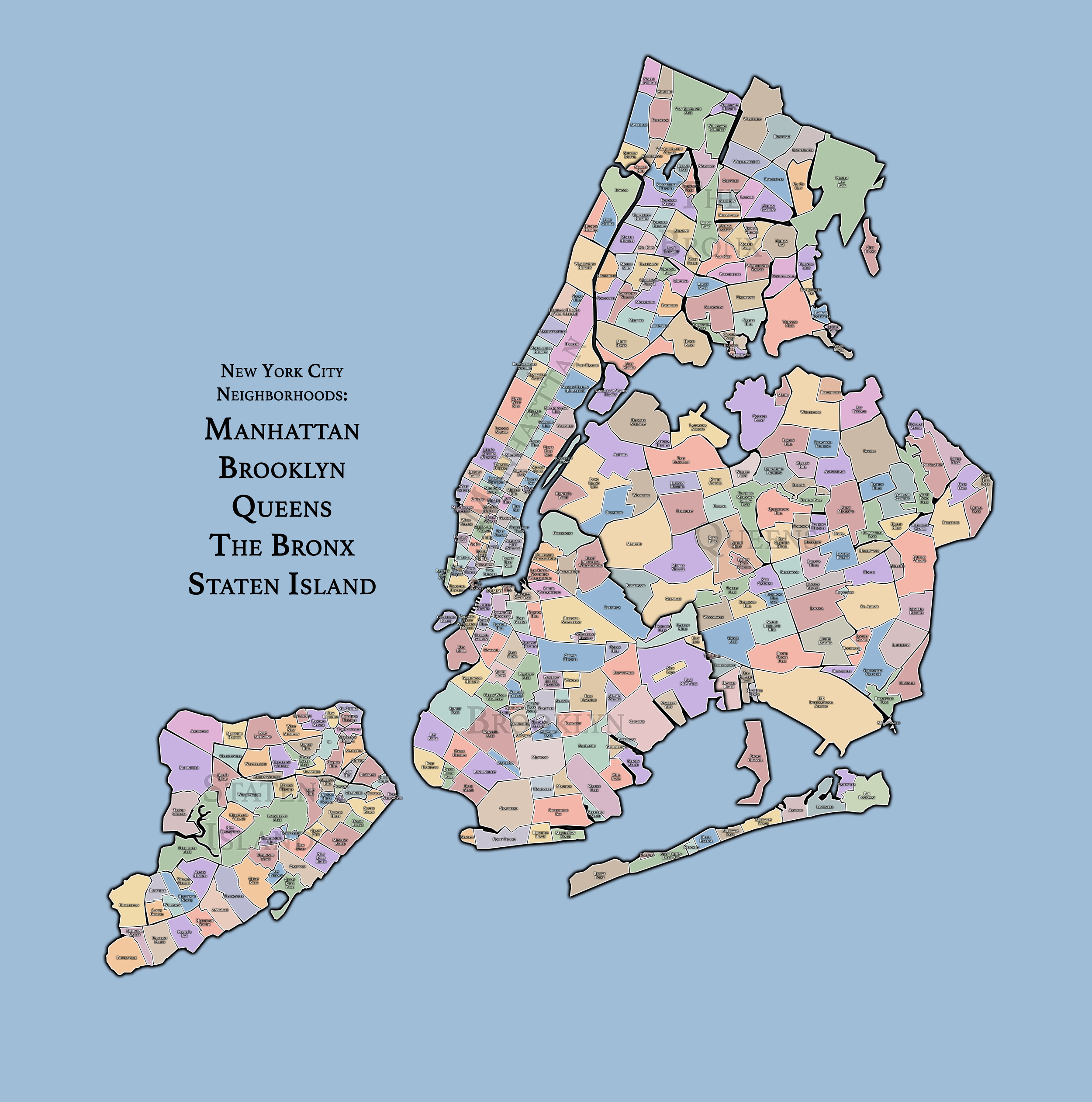
NYC Neighborhood Maps: Manhattan - Brooklyn - Queens - The Bronx - Staten Island
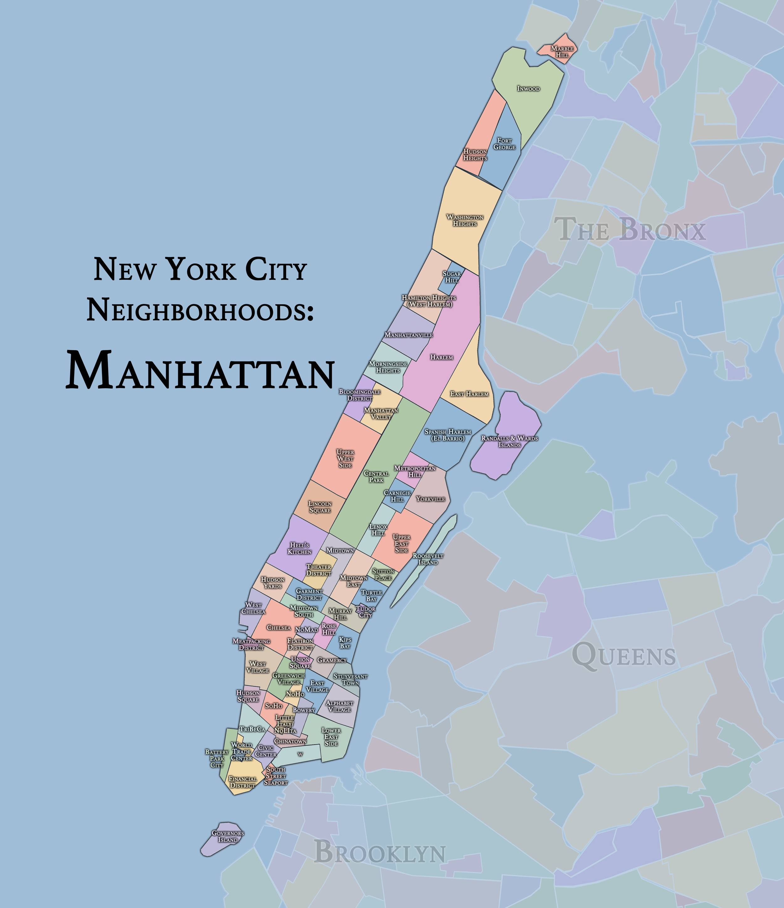
NYC Manhattan Neighborhoods Map
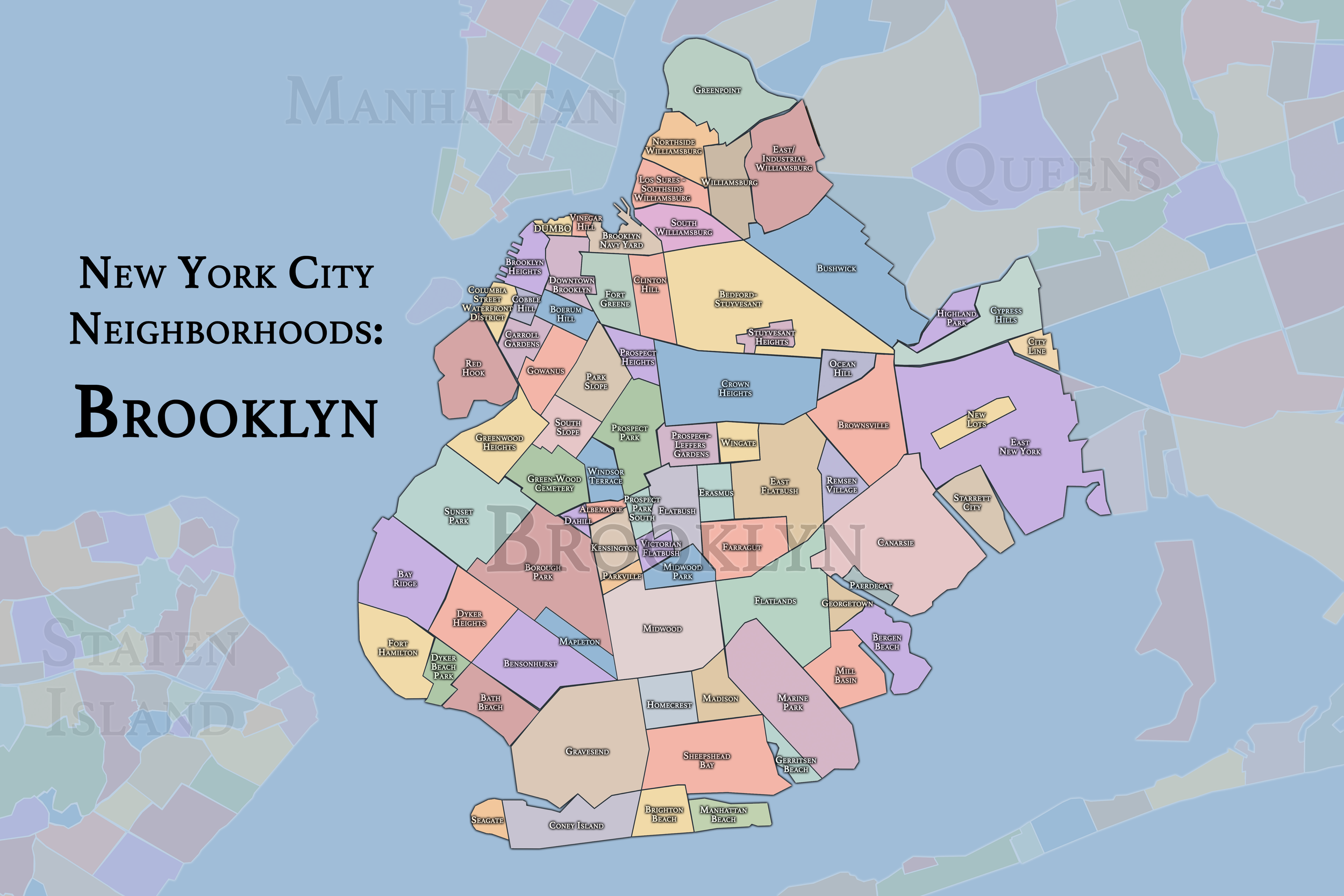
NYC Brooklyn Neighborhoods Map
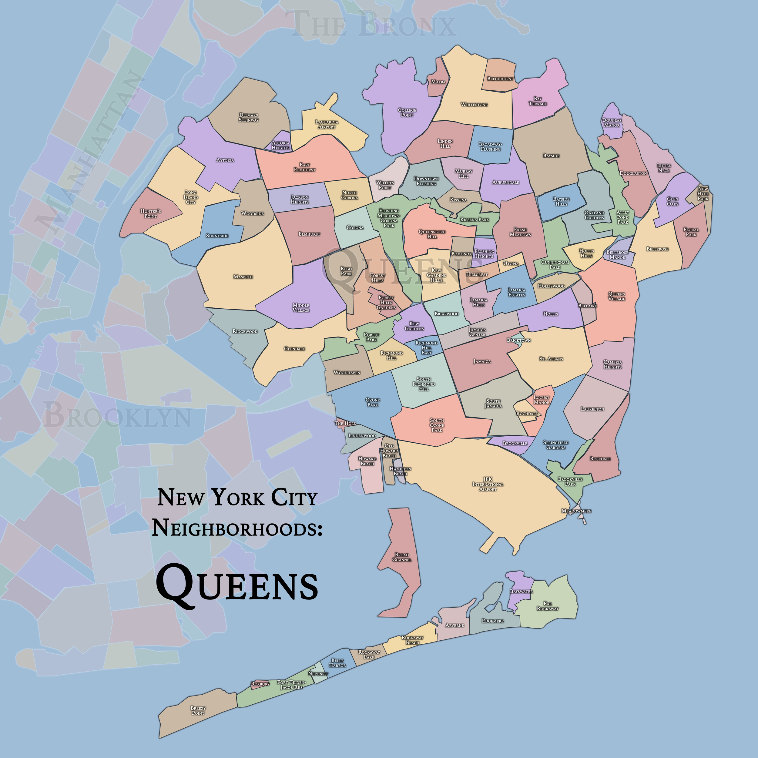
NYC Queens Neighborhoods Map
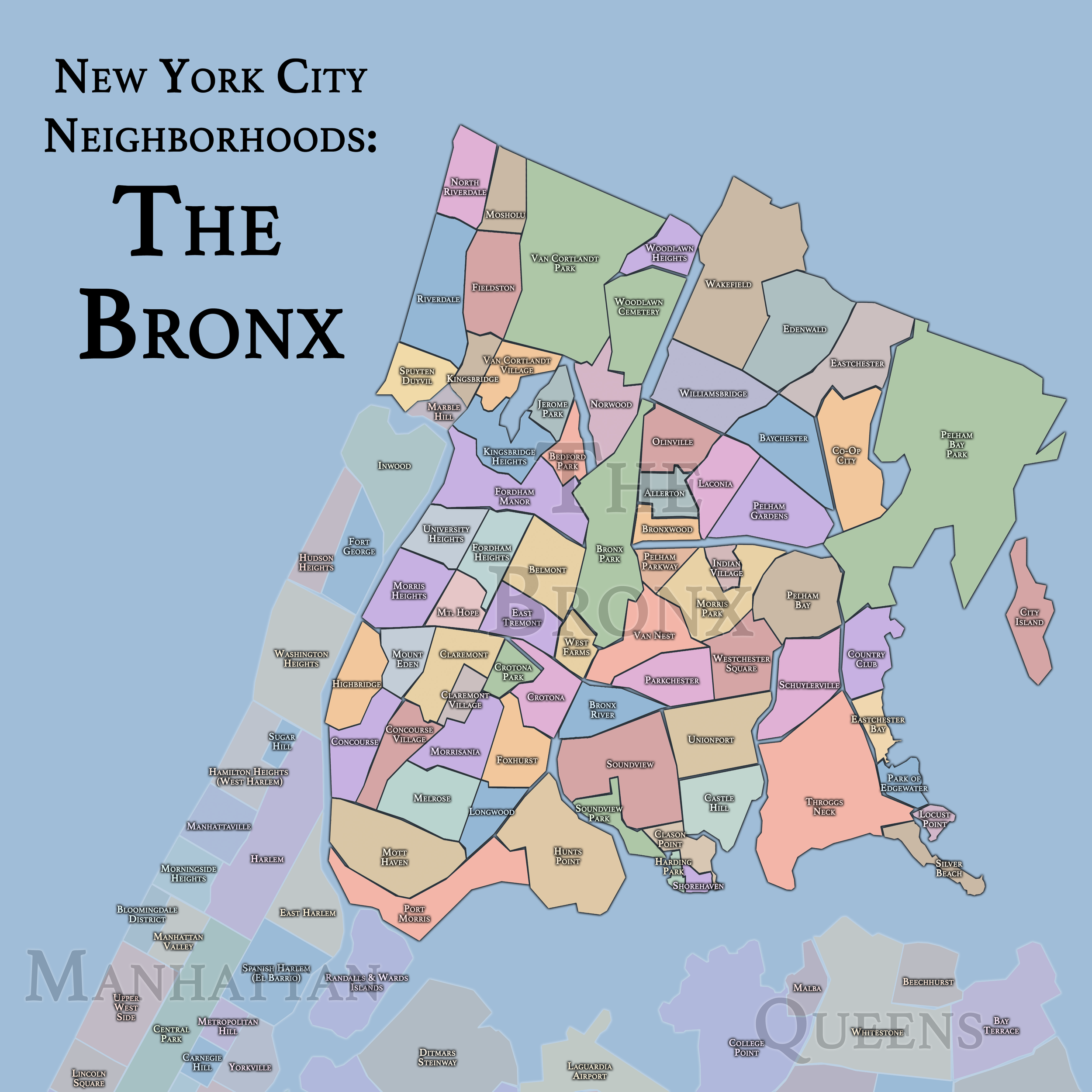
NYC The Bronx Neighborhoods Map
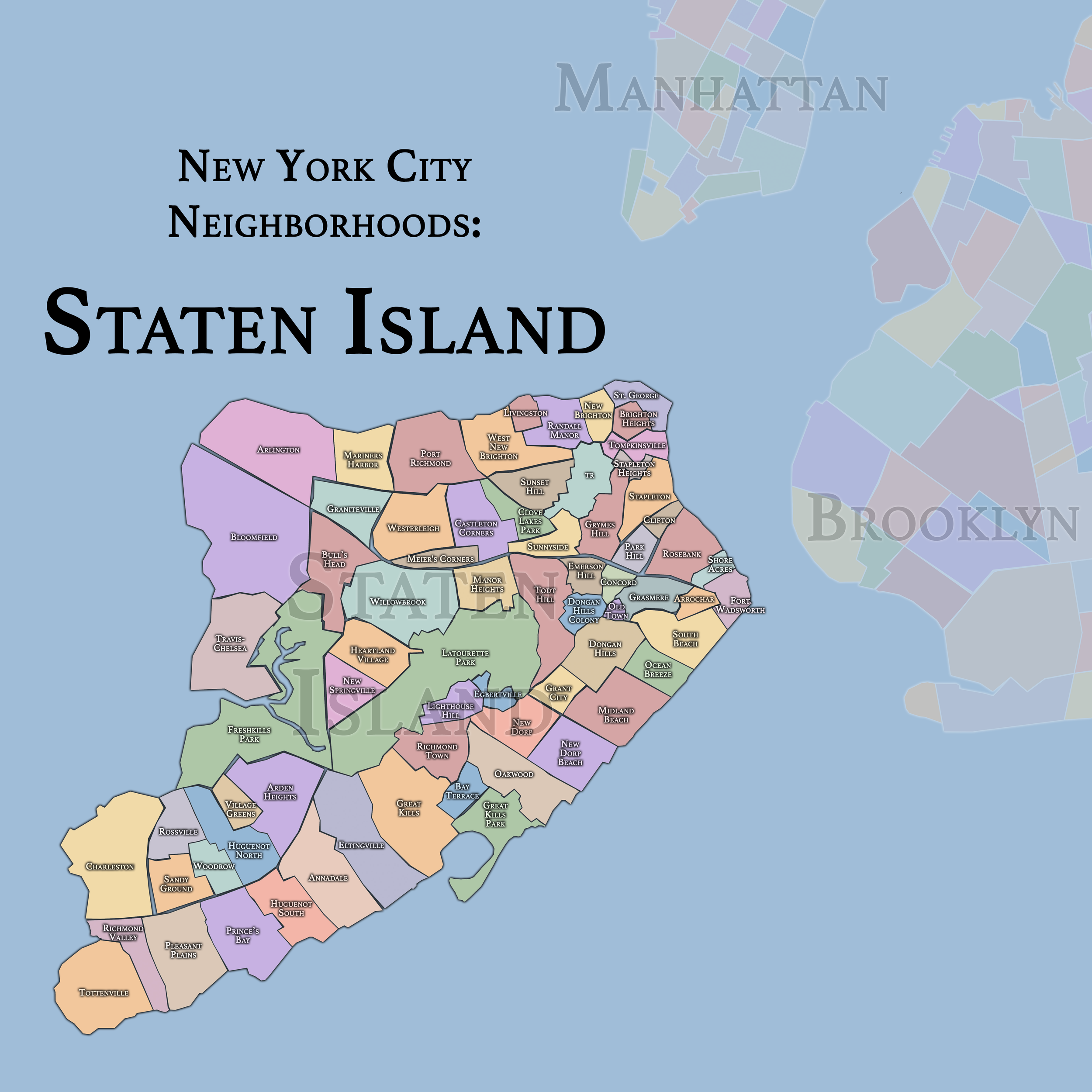
NYC Staten Island Neighborhoods Map
Our Story:
The CityNeighborhoods Project got its start in 2011 on the streets and in the neighborhoods of Manhattan. The premise was simple: Explore and photograph the city. NYC is much more than its landmarks and attractions so I set off on a journey of exploration, where every block promised something new and different (to the explorer). Discovering the personality and uniqueness of each street led to a catalogue of photos centered on the personality and unique qualities of the diverse neighborhoods on the island of Manhattan.
As of 2015, the project completed a walking and photography tour of every neighborhood in Manhattan. The next phase reached a crescendo in 2023, after walking and photographing every neighborhood in all five boroughs of New York City in one calendar year.
Since then, the project continues to document the ongoing transformation of New York City, while also expanding to international neighborhoods, as well as others here in the United States of America.
This website chronicles those explorations and photographs in both gallery and blog format.

CityNeighborhoodsNYC Portfolio

New York City
The Five Boroughs
Use this custom Google map to explore where every neighborhood in all five boroughs of New York City is located.
One of New York City’s unique qualities is its organization in to 5 boroughs: Manhattan, Brooklyn, Queens, The Bronx, and Staten Island. These boroughs are part pragmatic administrative districts, and part vestiges of the region’s past. Each borough is an entire county in New York State - in fact, Brooklyn is, officially, Kings County, while Staten Island is, officially Richmond County. But that’s not the whole story …
Initially, New York City was located on the southern tip of Manhattan (now the Financial District) that was once the Dutch colony of New Amsterdam. Across the East River, another city was rising: Brooklyn. In time, the city planners realized that unification between the rapidly rising cities would create commercial and industrial opportunities - through streamlined administration of the region.
So powerful was the pull of unification between New York and Brooklyn that three more counties were pulled into the unification: The Bronx, Queens, and Staten Island. And on January 1, 1898, the City of New York unified two cities and three counties into one Greater City of New York - containing the five boroughs we know today.
But because each borough developed differently and distinctly until unification, their neighborhoods likewise uniquely developed. Today, there are nearly 390 neighborhoods, each with their own histories, cultures, cuisines, and personalities - and each with residents who are fiercely proud of their corner of The Big Apple.


